Behavioural, Ecological and Socio-economic
Tools for Modelling Agricultural Policy
Insider
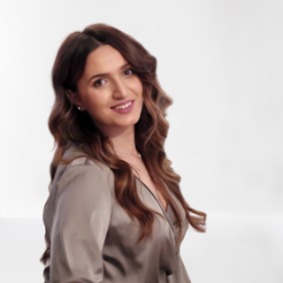
Stefanija Stojkovic
1. What is your professional expertise?
I obtained a BSc and an MSc degree in Geodesy and Geoinformatics at the Faculty of Civil Engineering, University of Belgrade, in 2017 and 2019 respectively, with a focus on the use of satellite imagery for the purposes of classification of biological habitats.
2. How did you become a PhD/Postdoc for BESTMAP?
Before I became a member of the PhD / PostDoc program, I heard from my colleagues from BioSense Institute about the project and how important it is modeling for agricultural policies. This led me to use and improve my knowledge gained in the field of geoinformatics and remote sensing through the BESTMAP project. As Serbia is not a member of the EU, it is my pleasure to work on redesigning and remodeling agricultural policy from the aspect of science.
3. What was your relation to BESTMAP before becoming a member of the PhD/PostDoc programe?
Before I became a member of the PhD program, I participated in solving different tasks from the project itself. My mentor from the BioSense Institute saw the possibility that the topic covered by the project and the data collected by the Institute could be combined and implemented through my research.
4. What is the topic of your dissertation/research?
The topic of my research is the classification of agricultural producers using geospatial and remote sensing data. The idea is to use the fusion of these data to determine the agricultural productivity on the basis of which the classification of farmers would be performed. In this way more precise Farm system archetypes coil be identified.
5. How would you describe your experience as a BESTMAP Early career researcher?
As I am currently at the beginning of my research career, I would describe my experience as a BESTMAP PhD student primarily as an opportunity for my personal progress, but also an opportunity to further share gathered knowledge with my colleagues at BioSense. As the project brings together experts from different countries, I am happy because I have the opportunity to be a part of it and learn through great technical and professional support from such an international team.
6. How did the project contribute to your academic progress?
The project itself contributed primarily to the creation of an idea on a topic for my research. The activities I performed on the project enabled me to develop and improve problem-solving skills, critical thinking, and quality time management.
7. To what extent were your studies intertwined with BESTMAP's work?
As a student of geoinformatics, during my studies, I had the opportunity to encounter various spatial data and remote sensing data. With my arrival at the BioSense Institute, I began to spread my knowledge in the field of agriculture. The knowledge and experience I gained during my schooling enabled me to fit into the BESTMAP project without problems and solve tasks.
8. Are you going to remain part of the BESTMAP team?
Yes, I will remain part of the BESTMAP team and look forward to continuing joint work with the BESTMAP team.
9. Would you recommend the BESTMAP PhD programme?
I would like to recommend the BESTMAP PhD program, because I believe that you can learn many new and interesting things, try new ideas, experiment with the latest technology, meet many new and interesting people and participate in interesting discussions while contributing to the community you belong to.
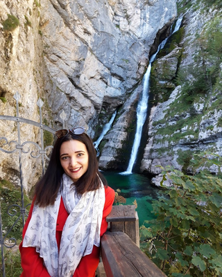
Nastasija Grujić
1. What is your professional expertise?
I am in my final year of Ph.D. studies in Geoinformatics. My research area includes a wide spectrum of data analytics, machine learning, and geoinformatics, which are used for better understanding and simulating complex spatial systems through individual and agent-based simulations.
2. How did you become a PhD/PostDoc for BESTMAP?
One of the aims of BestMap is to design a policy tool that would include social, cultural, biophysical, and spatial aspects using the technology of agent-based modeling. That tool should help us in finding an optimal design of agro-environmental schemes (AES) that would increase the adoption of AES among farmers and hence positively affect the environment. As for Serbia, since the AES has not been introduced yet, this project holds special importance for my country. My expertise here and my personal interest in improving agriculture sustainability in our country met projects requirements, thus I was included.
3. What was your relation to BESTMAP before becoming a member of the PhD/PostDoc programe?
I was included in the BestMap project from the start, as my technical skills and background were in line with project requirements. Before that, I was working on using ABM as a policy tool in the field of transport and the environment.
4. What is the topic of your dissertation/research?
My topic is related to building spatial decision support systems that are based on using diverse data sets, machine learning, and agent-based modeling for sustainable development.
5. How would you describe your experience as a BESTMAP Early career researcher?
When I started learning the agent-based modeling paradigm, I was reading papers by authors with whom I have now the opportunity to work! I feel honored to be able to learn from them. Besides that, the experience of working in a multi-cultural environment, with people coming from different technical backgrounds, has given me an opportunity to observe the same problem from different angles, open my horizons, and improve as a scientist.
6. How did the project contribute to your academic progress?
The project contributed to my academic progress from several aspects. It united scientists from 5 countries across Europe with different expertise and backgrounds. I have learned to
understand and integrate concepts from other disciplines, work in a team, communicate, and collaborate to solve specific problems. Through this project, I have developed personally just as much as I have grown professionally. All the lessons learned will to a certain extent contribute to my Ph.D. dissertation.
7. To what extent were your studies intertwined with BESTMAP's work?
To a great extent. Thanks to the knowledge I have acquired during my studies and my previous work, I have an opportunity to be a member of the BestMap team and to continue developing.
8. Are you going to remain part of the BESTMAP team?
That's the plan! :)
9. Would you recommend the BESTMAP PhD program?
Yes, of course! I think it is an excellent opportunity for personal and professional development!
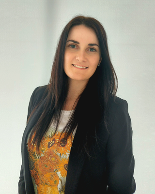
Miljana Marković
1. What is your professional expertise?
I am a PhD student of Geosciences with a BSc and a MSc degree in Geodesy and Geomatics. My research is focused on applying remote sensing and geoinformatics in the field of agriculture, more precisely crop classification.
2. How did you become a PhD/PostDoc for BESTMAP?
I became a member of the PhD programme for BESTMAP when I joined the BioSense Institute, in my first year of PhD studies. Considering my knowledge and personal interests, this project has been a great opportunity to get involved in task solving and expand my skills and experience.
3. What was your relation to BESTMAP before becoming a member of the PhD/PostDoc programe?
Before becoming a member of the PhD programme, as a student in the field of geoinformatics, I have worked with remote sensing data and developed certain skills that were suitable for participating in the project.
4. What is the topic of your dissertation/research?
The topic of my research is related to crop classification using machine learning and remote sensing data. It is very useful to know what crops are present in the fields. Therefore, crop classification is valuable for the determination of agricultural policies, as well as for crop production estimation and food security.
5. How would you describe your experience as a BESTMAP Early career researcher?
As an early career researcher, BESTMAP project gives me an excellent opportunity to develop. Considering that I have been included in the project from the very start of my PhD studies, it is a significant experience for me to work and to combine knowledge with scientists from different fields in order to solve various problems. It is an incredible feeling knowing that you are part of the group that works towards sustainable agriculture.
6. How did the project contribute to your academic progress?
Being a part of this project has helped me to improve my technical skills through solving specific problems, given me more experience of working in a team and broadened my insight into challenges and required approaches for defining regulations of precise agriculture.
7. To what extent were your studies intertwined with BESTMAP's work?
During my schooling, I have acquired expertise in the field of geoinformatics while working with different types of data and participating in many team projects. Therefore, my studies and the knowledge gained were very applicable for the purpose of BESTMAP project and the tasks it involves.
8. Are you going to remain part of the BESTMAP team?
Yes, I’m proud to be a part of a project of this kind and I plan to remain in the BESTMAP team.
9. Would you recommend the BESTMAP PhD programe?
Certainly, I would recommend the BESTMAP PhD programme, primarily because the idea and the aim of the project are of significant importance for the environment and agriculture sustainability. Besides that, it is a wonderful opportunity for growing both as a researcher and an individual.